You would be astounded to know that Saudi Arabia has more than 2,000 volcanoes in the Western province. In addition, there are huge 12 lava fields called Harrats. They run north to south of the kingdom along the Red Sea coast.
Harrat: Arabic for a large area of rocky, stony terrain of volcano field

They take up more than 80,000 sq km of space and run in a long chain starting in Syria/Jordan in the north down the entire length of the western region of Saudi Arabia ending in Yemen in the south.
There are many amazing caves too. They can be found mostly in the limestone regions of the north and east of the kingdom. They were formed during an era when the Saudi climate was very wet.
Though the kingdom has many volcanoes, it has fewer (as yet) known caves. Those that have been discovered can be found in the high coral limestone regions along the Red Sea coast and on the huge basalt lava fields.
After volcanic eruptions, huge, long lava tubes formed to carry molten lava away. As the lava slowly oozed down the side of the volcano, the molten lava gradually disappeared from the lava tubes and left many of them empty.
Today, they can be seen as amazing deep caves ready for exploration.
Over the centuries, most of the 2,000 volcanoes in Saudi Arabia erupted and produced lava tubes including underground caves. Some of those caves have been discovered. Many though have not. It is still possible that hundreds more still exist below the ground waiting to be found. Only time will tell.
Courtesy Google Earth
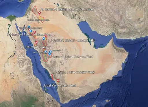
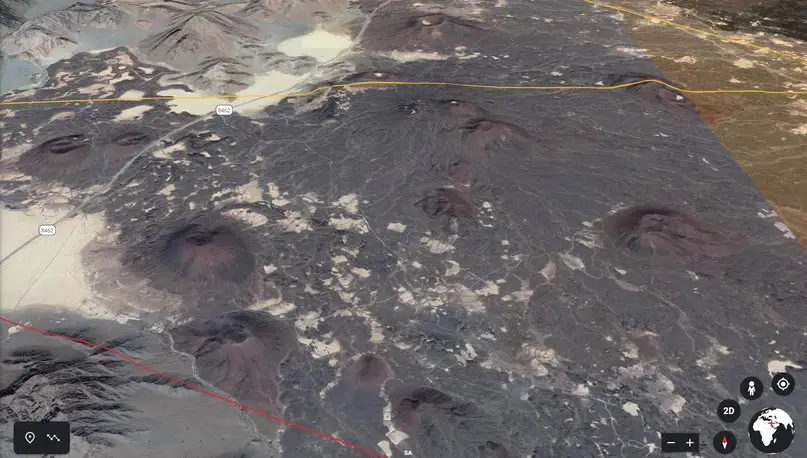
This article presents information about 10 of the most important basaltic volcanic fields to be found in the western region of Saudi Arabia. It is for visitors and tourists alike. You can read about the main features, the location and how to find them if you want to visit.
List Of The 10 Important Volcanoes in Saudi Arabia
| No | Name | Province/City | Field Size (m) | No |
| 1 | Jabal Yar | South/E.Jizan | 305 | 3 |
| 2 | Al Birk | South/NE.Abha | 381 | 1 |
| 3 | Kishb | Central/ S. Daghba | 1,744 | 3 |
| 4 | Rahat | West/S. Madinah | 1744 | 1 |
| 5 | Lunayyir | West/Umluj | 1370 | 1 |
| 6 | Khaybar | West/NE.Madinah | 2093 | 1 |
| 7 | Ithnayn | West/S.Hail | 1625 | 1 |
| 8 | ‘Uwayrid | West/N. Al Ula | 1920 | 1 |
| 9 | Rahah | West/S.Tabuk | 1950 | 1 |
| 10 | SharmahAl Harrah | North/E.Arar | 1100 | 1 |
What Is A Volcano?
A volcano is a big hole in the earth from which hot magma (liquid rock) and melted rock, ash, cinders and dissolved gas escape during a volcanic eruption.
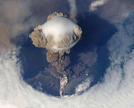

Some explosions (Strombolian blasts) are violent and dramatic. They send ash, rock fragments including bombs of lava hurling high into the air.
Others are low-level eruptions (Hawaiian flows) where thick hot magma (500°C to 1,170 °C) bubble and fizz out of ground vents but produce very little ash or gas.
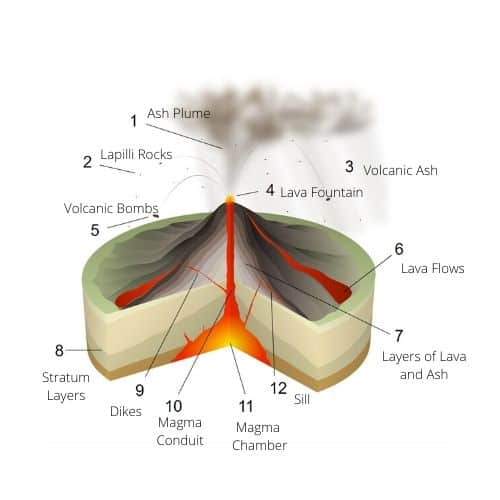

Over time, on a flat volcanic area or field, large mountains or hills take form out of solidified lava and ash. Their shape and height depend on the structure of the earth’s crust, the type of hole, the nature and amount of magma that is discharged, the temperature, pressure, water content and the way that molten lava falls and solidifies around the hole.
Generally, there are three types of volcano:
- Active – Recent and Future Eruptions Possible
- Dormant – No Recent Eruptions but Future Eruptions Possible
- Extinct – Eruptions Are No Longer Possible
Why Does Magma Escape Out Of The Earth’s Crust?
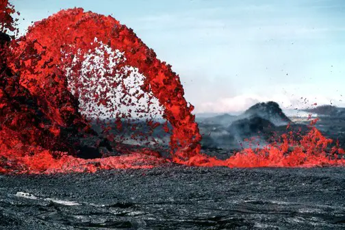

The image above shows the arching fountain of a Pahoehoe shooting up about 10 m high. It comes out of the west of 0740 which is a chain of vents, spatter cones measuring 170 m long, located south of Pu‘u Kahaualea.E Courtesy Wikipedia
Magma is made when very high temperatures cause the earth’s lower crust or its mantle to melt. This magma and the dissolved gases it contains escape through a vent or opening in the earth’s surface.
There are four main causes of volcanic eruptions:
- The Lightness of The Magma
- The Pressure of Gasses in The Magma
- New Magma Forced Into An Already Full Magma Chamber
- Shifting Tectonic Plates
The Lightness of The Magma
Due to its lightness, magma rises to the earth’s surface. It does this because as rocks melt deep within the earth, its mass stays the same but the melted rock increases in volume. During this process, it becomes less dense than the rocks which surround it and naturally rises to the earth’s surface.
The Pressure Of Gasses In The Magma
Before magma rises to the earth’s surface, the dissolved water in the magma is at about 5% saturation. As it rises, excess water separates from the magma due to its decreasing solubility and bubbles are formed.
This exiting water causes the ratio of gas to magma to ever increase. When the bubbles get to 75%, the magma then becomes pyroclastic, (fragments) resulting in fountains or spatters of explosive blobs of molten lava to be ejected into the air at the surface.
New Magma Forced Into An Already Full Magma Chamber
Hot magma is forced to the earth’s surface through the conduit (tunnel) because new magma squeezes into an already full magma chamber. The intense pressure causes the magma to rise and an eruption to occur at the surface.
Shifting Tectonic Plates

Plates Move Away
When the tectonic plates in the earth’s crust move away from each other, a gap is produced and magma rises from deep within the earth to take up space. This results in volcanoes under the sea.
Plates Move Together
When the same tectonic plates move against each other, the earth’s crust is forced downwards. This movement deep into the earth at high pressure and at a high temperature causes the crust to melt and for the magma to rise.
Hot Spots
From deep inside the earth, a thermal plume (featherlike) melts rocks under the tectonic plates (lithosphere). The resulting magma rises through gaps in the earth in eruptions to eventually form volcanoes.
The 10 Important Volcanoes in Saudi Arabia
1. Jabal Yar
| Name | Jabal Yar |
| Location | Jizan/Abu Arish (South-Yemen Border) |
| Map | 17.05°N / 42.83°E |
| Number of Volcanoes | 3 |
| Names | Qummatain Djar’tain Ukhwatain |
| Type | Small, Basaltic Field |
| Summit Elevation | 305 m / 1,001 ft |
| Eruption Style | Effusive |
| Last Eruption | About 1810 (VEI 2) |
| Status | Dormant |
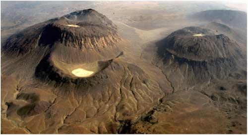
Jabal Yar is a small sleeping basaltic volcanic field located in Jizan in the South of Saudi Arabia. There are three groups of volcanoes (Harra) at the Jabal Yar field called:
- Qummatain (Twin Peaks)
- Djar’tain (Two Levels)
- Ukhwatain (Two Brothers)
There are also hot springs located between Qummatain and Dajar’tain, Ukwatain. Jabal Yar erupted in 1810 or thereabouts with a small eruption with lava flows. It is still considered to be active and historically it is the only one in Saudi Arabia.
Directions to Jabal Yar
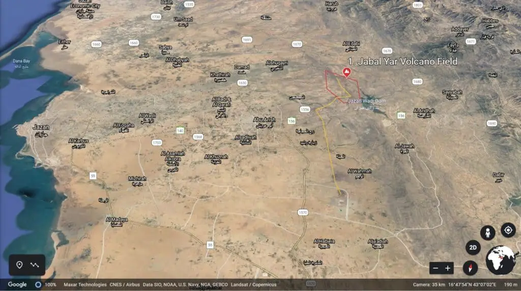
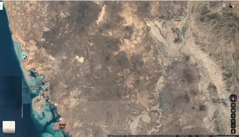
Jabal Yar can be found by driving northeast out of Jizan City for 30 km on route 140. When you get to the small town of Abu Arish, there are two small cones about 7km south of the town on Route 1570 road right opposite the Al Hasma Housing compound in the direction of Al Wahma.
The remaining long line of cones lies 8 km north of the small town of Abu Arish on Route 156 or alternatively on route 1556, but its more difficult.
Drive on Route 156 towards the huge Jizan Wadi Dam. 2 km after reaching the Jizan Military Hospital and before you get to the dam, take a left and drive north to towards the large housing compound.
Opposite the housing compound, you will see the first (huge) scoria cone on your right. Turn left off the road and drive around the first scoria and instead of driving towards Al Saad Park next to the dam, take another left off-road to head to the area north of the Jizan dam.
You will see a large rectangular walled enclosure on your left. You can miss it. After another 3-4 km, there are three more huge cones on your left after about you pass the Umm Al Marniq School on your right.
To get around the scoria cones you can walk or go off-road at this point.
2. Al Birk
| Name | Harrat Al Birk |
| Other Names | Hayil Hubhub Al Shaikh |
| Location | Al Birk, Abha (West On Red Sea ) |
| Map | 18.37°N / 41.63°E1 |
| Number of Volcanoes | 1 |
| Names | Jabal Ba’a Vent |
| Type | Small, Young Basaltic Field 1800 sq km |
| Summit Elevation | 381 m / 1,250 ft |
| Eruption Style | Effusive |
| Last Eruption | Less Than 100 years |
| Status | Dormant |
Harrat Al Birk is a young and fairly small dormant basaltic volcanic field located in the northeast of the town of Al Birk in the Abha region on the Red Sea coast in Southern Saudi Arabia. It lies between the two coastal planes called Tihamat Ash-Sham and Tihamat ‘Asir.
Al Birk field consists of a series of about 30 small to medium-sized cinder cones and lava flows over an area of 1800 sq m. There was possibly an eruption less than a hundred years ago at the Jabal B’aa vent which lies slightly to the west of the main field due to the suggestive ash deposits found there.
Directions To Harrat Al Birk
After the Al Birk town beach, you can see a large roundabout next to the Border Guards base. Take the Al Madeed exit, then drive northeast for about 30 km.
As you drive for 15-20 km you will begin to see small scoria cones on your left (3) and right (2).
The main volcano field is further north on your left. You can see the large cones as you drive north to the small town of Al Madeed.
The large cones are difficult to access. There are some mountain roads and you will need a good off-road vehicle to fully explore the 10 remaining scoria cones and lava flows in the area.
3. Al Kishb
| Name | Harrat Al Kishb |
| Other Names | |
| Location | Central |
| Map | 22.8°N / 41.38°E |
| Number of Volcanoes | 5 + 1 Maar |
| Names | Jabal Aslaj Jabal Hil Jabal Shalman Jabal Zuwayr Jabal Abu Haris Al Wahb Maar |
| 5 Caves | Kahf Al Al Shabaah Kahf Al Mut’aib Kahf Bushy Window Cave Kahf Dahl Faisal |
| Type | Basaltic, Pleistocene |
| Size | 5,900 sq m |
| Summit Elevation | 1475 m/4,839 ft |
| Eruption Style | Effusive |
| Last Eruption | 10,000 years ago |
| Status | Dormant |
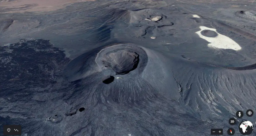
Harrat Al Kishb is a basaltic volcano field that contains maars, scoria (cinder) cones, tuff rings, lava flows, and domes.
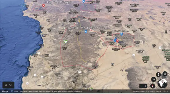
It is located 300 km northeast of the city of Mecca.
It originated during the Pleistocene era between 2,580 and 0.12 million years ago. The lava flows you can see there are from the Holocene period and are about 12,000 years old from a time when the glaciers disappeared. They are located in the Western half of the field.
Al Kishb has the following features:
5 Explored Prominences and 1 Giant Crater
- Jabal Aslaj is a scoria cone with lava flows that contain granite clocks.
- Jabal Hil is a prominent scoria cone that has an impressive huge crater that got filled up with lava and eventually covered with water to become a lake.
- Jabal Zuwayr has a whaleback hump.
- Jabal Abu Haris is a tuff ring.
- Jabal Shalman has a lava dome, flows, and scoria conical shape that are about 6,000 years old.
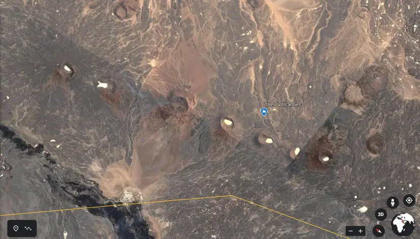
- Seven Volcanoes
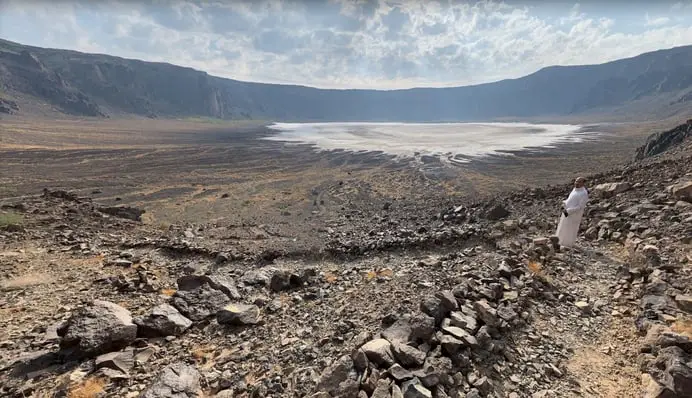
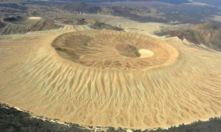
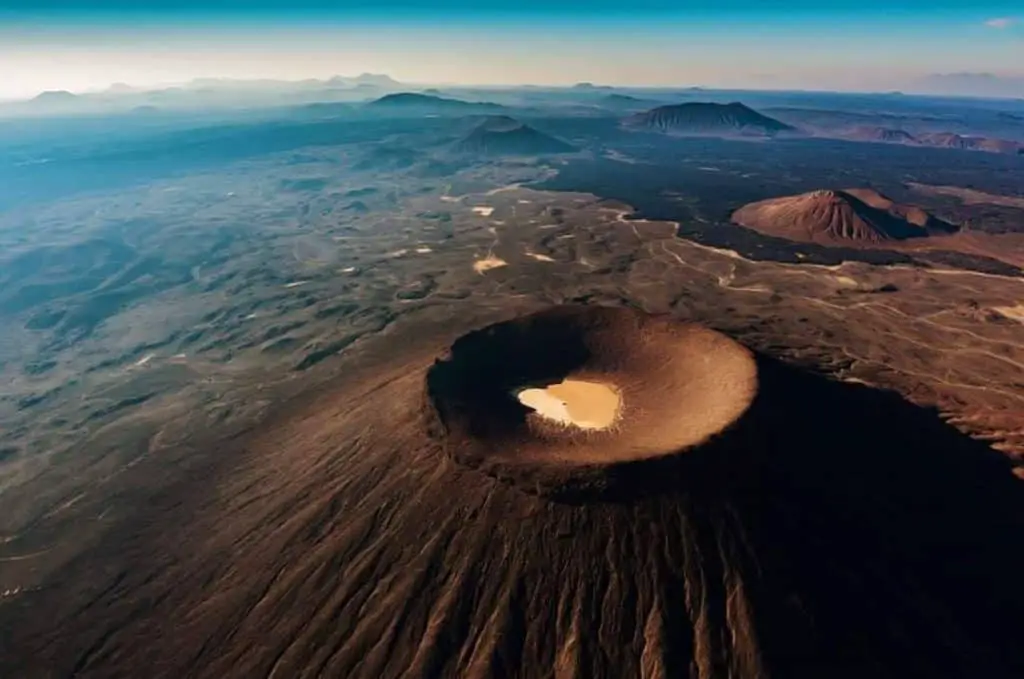
Al Wabah Maar (crater) is massive nearly 2 kilometers wide and just less than 1 kilometer deep and is located in the west of the field.
You can drive to the crater entrance at Maqla Tamiyah. There are toilets and a small visitor center there. You can descend in return to your car in about 1 hour. The path is rocky and slippery underfoot when wet. Take care!.
Lava Tube Caves
Around the field, there are also some wonderful caves that people visit and climb about inside. In fact, they are lava tubes. There are 6 in total located in three separate areas in Hafir Al Kishb.
- First Shaft Cave
- Kahf Al As Shabbah (Kahf=Cave Shabbah=Ghost)
- Kahf Bushy
- Kahf Al Mut’aib (Kahf=Cave Mut’aib=Name of Male)
- Kahf Window
- Kahf Dahl Faisal
The Caves of Al Kishb
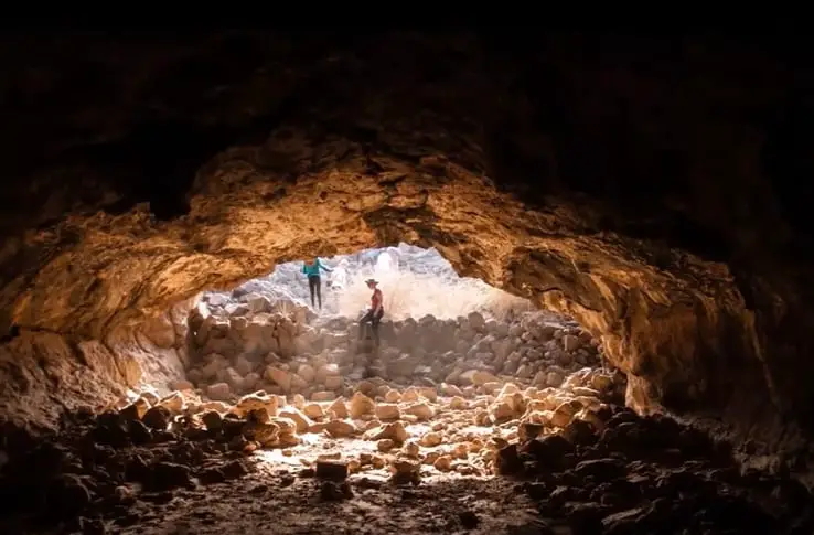
The biggest and the longest lava tube is located to the west of the scoria cone of Jabal Hil. It erupted thousands of years ago. After the eruption, the lava tube drained and it collapsed. You can still see inside the inner tube which is over 20 m high and goes down 42.5 km below the ground level.
The First Cave can be seen from above down a dangerous loose rocked 26.5 m shaft. Take care!
In the East of the field, the second is the largest called Kahaf Al Shabah (Ghost Cave) has two main tubes measuring 140 m and 143 m.
There are also two smaller caves nearby called Kahf Bushy and Al Mutaeb. Close by there is a single erosion cave called the Window Cave which is only 1 m deep.
The sixth cave is called Kahf Dahl Faisal. It is located close to Jabal Hil in the basalt north of the field. It is 22m long.
The lava tube caves are elliptical (egg-shaped) in shape and contain lava stalactites on the ceiling and lava levees (edges or prominences) on the walls. These tube caves are half-filled with sand washed in by the rain and dust from the wind.
Directions To Harrat Al Kishb
The distance to the Harrat al Kishb is 350 km and it takes four hours to drive there from Jeddah. Drive from Jeddah to Taif City. This takes 2 hours and it is 172 km. The traffic lights entering the Riyadh road in Ta’if junction can get very crowded so allow for delays.
From Taif take the Riyadh road and drive northeast on Route 80 for 1 hr 45 mins or 193 km until you arrive at the Al Wesam Gas Station on your right.
Then, drive for a further .5 km after the gas station until you get to the A440. Then, take a left on the A 440 towards the village Um Al Doom for 60 km. It takes 40 minutes.
At Um Al Doom drive on until you get to the village of Nimran 25 km. It takes 22 minutes. Then, from Nimran drive onto Maqar Al-Sharif for 3.3 km on Route 4174. It takes 4 minutes. Finally, you will arrive at Hafir Al Kishb after 22km. It takes 16 minutes.
4. Al Rahat
| Name | Harrat Al Rahat |
| Other Names | |
| Location | SW/ Madinah, |
| Map | 23.08°N / 49.78°E |
| Number of Volcanoes | Scoria Cones, Shields Domes |
| Names | |
| Caves | |
| Type | Young Basaltic |
| Size | 20,000 sq km 300 km long 60 km wide |
| Summit Elevation | 1744 m / 5,722 ft |
| Eruption Style | Effusive |
| Last Eruption | 1292 AD, 1256 AD 640 AD |
| Status | Dormant |
Harrat Al Rahat is easily the biggest volcano field in all of Saudi Arabia. It starts just 10 km south of the city of Madinah and extends 300 km south to approximately 70km from the northern boundaries of the city of Taif. It is between 60 and 80 km wide at various points.
There are six-seven lava flows, four massive ones measuring 100 km wide and much of the activity is in the northern part of the field. The huge long vent which produced the flows runs north, northwest. The field consists of tens of scoria cones. It also has shield volcanoes and domes that were produced from pyroclastic flows and surge deposits.
The tens of scoria cones and rings align almost perfectly along one huge vent running North to South for the whole 300 km distance from Madinah to Taif.
Harrat Al Rahat last erupted in 1256 AD from out of six scoria cones. The resulting 500 million m3 lava flows reached to within 23 km of the city of Madinah. You can still see them today.
The nearest lava flows can be seen from the city at the King Khalid Ring Road opposite the Taibah University College and Taibah University College. In fact, there are 10 separate flows reaching almost to the city in a huge spider-like formation.
The most impressive cluster of scoria cones and shield volcanoes can be seen 35 km southeast of the city of Madinah out on the Ali Ibn Abi Talib Road.
Directions To Harrat Al Rahat
Start your trip from the center of Madinah at the Main Hospital and Maternity Hospital. They are right at the start of Ali Ibn Abi Talib Road. Drive out of the city crossing the King Khalid Ring Road. Continue until you reach the vehicle inspection point which covers the road. After 25 km you will begin to see more of the massive lava field both right and left of the road and small tuff rings will appear.
Continue until 32 km and you will see a mosque (Masjid Al Thamaani) on your right and the first scoria cone behind it. Beyond this, there are many more features besides.
From the mosque, you can drive up the first dome to see the view of the other shields and cones behind it. There is an exit onto the volcano field on your right just 1 km before you get to the mosque.
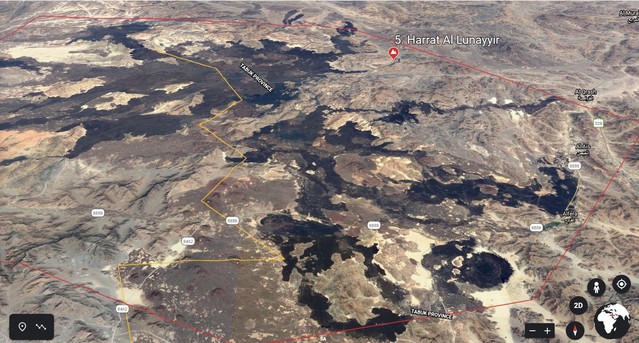
5. Al Lunayyir
| Name | Harrat Al Lunayyir |
| Other Names | |
| Location | West, Tabuk 55km East of Umluj |
| Map | 25.17°N / 37.75°E |
| Number of Volcanoes | 1 |
| Names | |
| Caves | |
| Type | Basaltic |
| Size | 180,000 sq m |
| Summit Elevation | 1370 m / 4,495 ft |
| Eruption Style | Effusive |
| Last Eruption | Before 1000 AD |
| Status | Dormant |
Harrat Al Lunayyir volcano is a basaltic field located on the Red Sea coast of Saudi Arabia the entrance of which is 85 km east of the beautiful town of Umluj.
The field is worth a visit and it contains the following features:
- 50 Scoria/Cinder Cones
- Lava Flows Running North-South
- 2 Lava Flows Reach The Sea
Al Lunyyir Earthquake
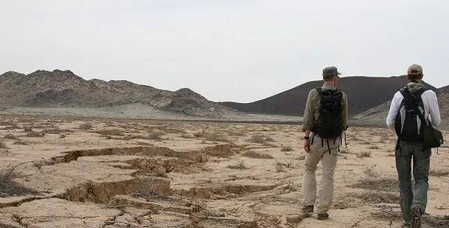
Courtesy Kaust
It erupted before the year 1000 AD. On 19th May 2009, 31 earthquakes (seismic swarm) occurred reaching a 5.7 magnitude. It made cracks and fissures in the ground. 2,889 people were evacuated to Yanbu City from an area of 20 km around the volcano including 326 families. Because of the earthquake, it is Al Lunayyir could now be volcanically active. The evacuees returned home in August 2009 after the all-clear was given.
Al Lunayyir was supposed to be inactive, due to its position on the borders of the continental rift, 200 km away from the active center beneath the Red Sea. As the continental plates pull apart, magma shoots up to fill in empty space. But, because of the fact that they are under the sea, they cannot be easily studied.
Read the Kaust Article about Wall of Magma and the widening fissure at Harrat Al Lunayyir .
.
One of the fissures measuring 3 km opened up to 8 km wide during the swarm quakes. Radar satellite pictures determined that magma has likely entered the widening rift and reached a shallow 2km deep an area of 10 km along the fissure.
As a result, scientists are on the alert for further quakes or seismic activity.
Directions To Harrat Al Lunayyir
The Al Lunyyir volcano lies 500 km north of Jeddah. To get there, drive north from Jeddah to Umluj on National Route 50. From Umluj town center, turn right at the Al Hawra hospital roundabout onto King Saud road. Drive east and continue on the King Saud road called Route 888.
Harrat As Shabahah
Follow Route 88 for 60 km and you will arrive a small cluster of scorias called Harrat Al Shabahah. They lie to the left (2) and right (10) of the Botanical Gardens just before the gas station.
Drive now until you arrive at the village of Al Fera after 25 km. About 10 km before arriving at Al Fera, look to your right and you will see another small cluster of six cinder cones and a beautiful small maar on your left.
As you enter Al Fera, you will see a bakery on your left and a mosque on your right. The entrance to the remaining volcano field is directly after the bakery on the left. Turn left and have fun exploring.
You can access another northerly series of cones from the village of Al Qurash which is 25 km due north of Al Fera on Route 888. When you arrive at Al Qurash gas station you will see an Al Rahji ATM on your right. Now, turn left onto the Al Marameh mountain road.
After 4 km on the Al Marameh mountain road, you need to turn left just after the massive black lava flow so as to reach the scoria zone which is about a further 35 km due west into the field.
It is a long road, and you will know you have arrived because before you get the scoria cones, you find a grocery store on your left and a small mosque on your right.
Drive a little further past the store and you will arrive at another black lava flow. Continue for another 15km until you reach 10 more scorias at the Harrat Al Lunayyir.
6. Al Khaybar
| Name | Harrat Al Khaybar |
| Other Names | Jabal Abyadh Jabal Baydha Jabal Qadr/Qidr |
| Location | NE 65 km North Madinah |
| Map | 25°N / 39.93°E |
| Number of Volcanoes | 1 Stratovolcano |
| Names | Jabal Qidr (symmetrical) |
| Caves | Long Lava Tubes Umm Jirsan |
| Type | Cenozoic Basaltic |
| Size | 14,000 sq m |
| Summit Elevation | 2093 m / 6,867 ft |
| Eruption Style | Effusive |
| Last Eruption | 650 AD / 29 AH |
| Status | Dormant |
Harrat Al Khaybar is a massive basaltic volcanic field that is a 100 km long line of landform running North to South containing vents, scoria cones, lava domes, mars and lava flows. It has Saudi Arabia’s only known stratovolcano called Jabal Qidr. It lies directly north of the city of Madinah, Saudi Arabia.
In the last 1,500 years, there have been 8 lava flows. One which flowed out of Jabal Qidr now extends for 55km. The last eruption occurred 1,400 years ago.
Al Khaybar borders the Ithnayn field (North) and the Kura field (West) in one giant uninterrupted area of basaltic lava fields measuring 20,564 sq km.
The entire field contains the following features:
- 327 Scoria Cones
- 46 Shield Volcanoes
- 20 Domes
- 5 Tuff Cones
- 1 Stratovolcano
- 30 Whaleback lava flows.
- White Lava Flows made of Comendite
- 400 Ancient Stone Works
Lava Flows
Lava flows from the three Harrats converge and overlap. These 5 million-year-old lava flows are particularly impressive for visitors who love a walk on them and stand astride the boundary where the black and white flows meet to take selfies.
Ancient Gates
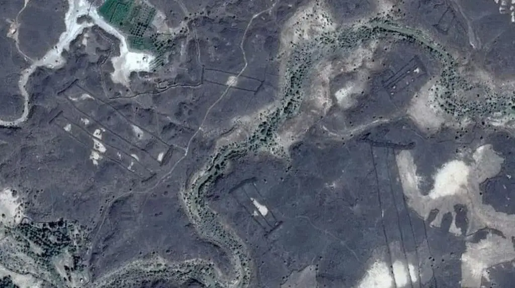
Also, in 2017, a Professor from the University of Western Australia using satellite imagery (Google Earth) discovered 400 mysterious stone structures thousands of years old. To date, no one knows what they were used for.
Click here to read Arab News article related to the discovery of the ancient gates in Harrat Al Khaybar
They are called gates because they appear like fallen field gates on the satellite imagery. Some are small about 13 m long whereas others are huge about 500 m across about being four times the size of a football pitch.
They were built on ancient lava domes and some go up to their sides. Some have lava flow over them so they predate some volcanic eruptions. The gates are low, roughly made and about 7-9,000 years old.
Directions To Harrat Al Khaybar
Starting at the City of Madinah, drive due North West on the National Route 15 for 155 km until you reach the town of Al Thamad.
Before you reach the volcanoes, it is worth visiting the old fort town of Khaybar 16 km north of Al Thamad. It is an ancient oasis stopover, once inhabited by Jews and retaken by Muslims in 629 AD. Most of it is in ruins.
Drive through Al Thamad until you reach the gas station (3 km). It has a little painted red and yellow mosque, a small hostel, shops, and petrol supplies.
At the petrol station, take a right and drive for 45 km until you reach the volcano field.
You will pass a Shisha/Coffee House on your left, then the Bin Mitran Mosque on your right after about 5 km. You will arrive at Rahbat Al Hosni village after a further 15km. From Rahbat, drive for another 5km. There you will start to enter the black mountainous landscape.
Drive north for another 20 km and you will begin to see the volcano field. There is a sign on your right for the direction to Umm Jirsan Cave. Here you can enter the volcano field on your right. It is off-road so you need a good SUV or high wheel based vehicle.
Click here to read an Arab News article about Saudi women taking up caving as a hobby in The woman unlocking mysteries of Saudi Arabia’s caves.
After you enter the volcano field and you must drive for 10km more. On your right, you will find Umm Jirsan Cave opposite the large volcanic mound.
If you don’t want to visit the Umm Jirsan Cave, continue north on this route for a further 26 km. It will take you directly to the Black and White Volanco lava fields. When you arrive, stop your vehicle and start exploring.
In addition to the Black and White volcano, you can walk and visit as many of the tens of cones, shields, and tuffs that make up the massive lava field.
It is exhausting but worth it. Also, consider a tour or going with an experienced guide who knows the terrain well.
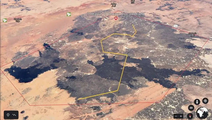
7. Al Ithnayn
| Name | Harrat Al Itnayn |
| Other Names | |
| Location | West, Ha’il Province |
| Map | 25.17°N / 37.75°E |
| Number of Volcanoes | Hazim Al KhadraN-S Vents |
| Names | Kahf Al ShuwamisKahf Shisma |
| Caves | Many |
| Type | Basaltic without silicon |
| Size | 4000 sq m |
| Summit Elevation | 1625 m / 5,331 ft |
| Eruption Style | Effusive |
| Last Eruption | Before 4500-1500 AD |
| Status | Dormant |
Harrat Al Ithnayn fields are basalt. They consist of about 20 vents but they are lined up a little more crookedly than other Harrats in Saudi Arabia. There are scoria cones and some small tuffs. They lie in an area of about 60 sq km, 200 km southwest of the city of Ha’il in Saudi Arabia.
The field is great and popular with campers and cave explorers. It has the following features:
- 20 Scoria Cones and Tuff
- 1 Huge and Smaller Craters
- Spawling Lava Flows
- Many Lava Tubes and Caves
- Rock Art
- Thermal Vents
The solidified lava flows are made up of basaltic rocks, but unlike the neighboring Harrat Al Khaybar, they do not contain silicon.
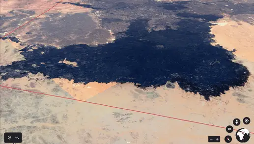
The Ithnayn field (North) joins with Harrat Al Khaybar to the south, the Kura field (West), and Harrat Rahat (Immediately South of Al Khaybar) in one giant uninterrupted area of basaltic lava fields measuring 20,564 sq km.
There are numerous caves that are lava tubes. The longest is Kahf A Shuwais (530 m). Two more well-known caves are located at the base of the Hazim Al Khadra volcano. Some caves feel very warm due to thermal activity from fumaroles originating in other shelter caves.
Eyewitness local bedouins have reported that they can see smoke-like vapor emanating from the vents of Harrat Al Al Ithnayn.
Directions To Harrat Al Ithnayn
The Harrat Al Ithnayn lies 200 km southwest of the city of Ha’il or 400 km north of the city of Madinah.
From Ha’il drive due south using Route 70. You will see the Grand Mall on your right and the Hail International Airport on your left as you leave the city.
You will pass the village of Suneynah on your left after 73 km. Drive on through the village of Dulayhan. There are shops and a good petrol station there. Continue until Hafirat al Shuqayq. From here drive to Al Shamili is another village 50 km south.
At Shamli you are at the northern entrance of the Harrat Al Ithnayn field. Now, drive south to Al Ma’saa. You can easily enter the volcano field from there. There are lots of entrances in the 60 sq km field area.
The huge crater is in the south of the field accessible from Al Khafj (40 km) or Al Swimes (60 km) and the Crater 70 km by road from Al Ma’saa.
8.‘Uwayrid
| Name | Harrat ‘Uwayrid |
| Other Names | |
| Location | NW/ 150 km from Wajh,Red Sea |
| Map | 27.08°N / 37.25°E |
| Number of Volcanoes | Hazim Al KhadraN-S Vents |
| Names | Hala Al BedrHala Al Ischia |
| Caves | |
| Type | Basaltic |
| Size | 130 km long |
| Summit Elevation | 1920 m / 6,299 ft |
| Eruption Style | Effusive |
| Last Eruption | 640 AD/10 AH |
| Status | Dormant |
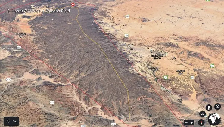
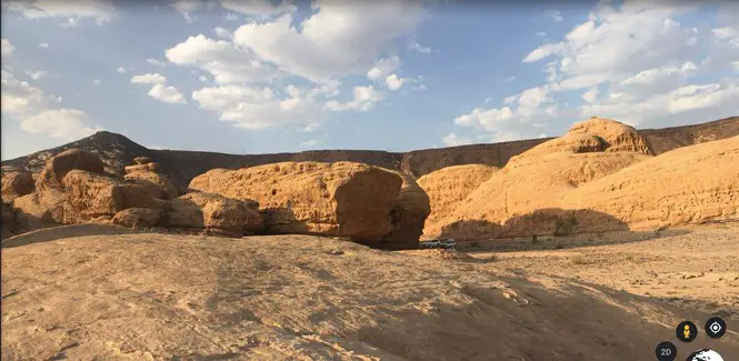
Harrat ‘Uwayrid is a huge basaltic volcano field that developed with the opening of the Red Sea continental rift. It lies about 150 km inland of the Northwestern town of Al Wajh on the Red sea coast. It has massive lava flows, scoria cones, and many tuff cones.
‘Uwayrid runs in a northwesterly to a southeasterly direction for about 125 km. It borders the Harrat Al Rahat volcano field. It begins slightly to the West of the famous town of Al Ula (12 km) and Ma’dain Saleh (45 km).
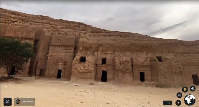
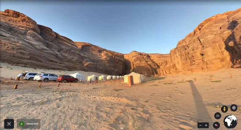
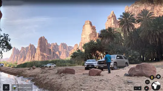
There are some of the most beautiful desert landscapes to be seen on Harrat Al Khaybar. There are many dramatic rockscape valleys cutting into the volcano field with golden sands, semi-permanent camping resorts, the ancient village of Al Ula, Tantora concert Hall, ancient tombs, caves, and ancient petroglyphic art,
The huge field on the southwest side is very popular with tourists and really worth a visit. It contains the following features:
- Many Scoria Cones
- Many Tuff Cones
- Massive Lava Fields
- Dramatic Towering Rockscapes
- Desert Camps for Tourists
- Ancient Caves
- Rock Art
- Dramatic Rocky Valleys
- Tantora Festival Hall
- Al Ula Village
- Dedan Tombs
- Ma’dan Saleh Ancient Site
Earthquakes first happened there during the Miocene era some 23- 5.3 million years ago and during the Pliocene era 5.3 – 2.6 million years ago.
The last known eruption at ‘Uwayrid was probably in 640 AD. Local Bedouin legend has it that Hala Al Bedr erupted fire and stones that killed shepherds and their sheep and animals.
Directions To Harrat ‘Uwayrid
Most of the coned features you might like to see are located at the North end of the field. They run along two fissure lines, one north to the east and the other from east to the West. The lava flows run to the east. Most cones are tuff rings.
From the town of Al Wajh so as to get to Harrat ‘Uwayrid, drive north on King Abdul Aziz street until you reach the King Khalid Road roundabout.
Then, head east (inland) out of the town of Al Wajid on the Red Sea coast using Route 8776. After 100 km, you will arrive at the first village called Bada. Here, you can rest and take a snack.
After that, drive north for a further 30 km and turn left on the 8451 towards the village of Al Nashaifah 30 km. On the road to Al Nashifah, you can see the boundary of Harrat ‘Uwayrid field very clearly.
Your destination is Abu Rakah (10 km). Here, you enter the volcano field on the right and can see many tuffs and features to the east of the village of Abu Rakah.
9. Al Rahah
| Name | Harrat Al Rahah |
| Other Names | |
| Location | SW/ 120 km Tabuk, Parallel Red Sea |
| Map | 27.08°N / 37.25°E |
| Number of Volcanoes | Scoria Cones Tuff rings |
| Names | |
| Caves | |
| Type | Young Basaltic |
| Size | 125 km long |
| Summit Elevation | 1950 m / 6,398 ft |
| Eruption Style | Effusive |
| Last Eruption | 1,000 AD |
| Status | Dormant |
Courtesy Google Earth
Harrat Al Rahah is a stunning basaltic volcano field that runs parallel to the Red Sea for about 125 km long. It is located 120km southwest of the city of Tabuk. You can also access it from the north coast of the Red Sea at a small town called Duba (100 km drive).
Harrat Al Rahah lies in northern, Saudi Arabia slightly inland 150 km of the Gulf of Aqaba and the border of the Kingdom of Jordan.
The field itself is young and is positioned south of the huge El Hisma plain running to the south of Tabuk.
The field is wonderful to visit and many people come to camp and explore the beautiful area. It has the following features:
- Many Scoria Cones and Tuff
- Spawling Lava Flows
- Gorges
- Oasis
- Rock Art
- Magical Towering Landscape
- Ancient Sites
- Camp Sites
- Hostels
- Great Off-Road Driving
The field consists of masses of raised lava flows running northeasterly direction. It is about 37 km at its widest and 3 kilometers at its narrowest point.
Viewed from the Red Sea town of Al Duba is rises up by an impressive 550 m above the Cambrian sandstone plain. The eruptions that occurred many years ago came about from a fissure in the crust. So, you will see a long line of amazing scoria cones and tuff cones stretching from North to South for about 80-125 km along an escarpment.
Al Disah Oasis & Gorge– Nature Sanctuary
Al Disah is an outstandingly beautiful cushioned in a long stretch of sand. The oasis is surrounded by towering sandstone escarpments and breathtaking peaks. It looks like a lunar landscape in a sci fie movie.
It is a magical-looking place. To reach there drive up the Wadi Qirqir river bed, lined with gushing freshwater springs and date palm trees and greenery on each side until you reach a deep gorge area with high cliffs on each side.
Dry in the summer, but usually gushing freshwater runs down its center in the colder months.
Now get out of the car and take time to explore. Climb up the conical sandstone rock cliff faces rising up above you.
Discover the ancient tombs hidden high up the cliff walls and witness the ancient petroglyphic artwork of human and animal figures (camel, ostrich, and antelope) known to be thousands of years old. It is delightful.
Further, into the village, there is a Nabataean tomb that is sometimes open and you can visit it.
Directions To Harrat Al Rahah
It is a 4-hour drive north of Umluj. Start your trip at Duba. First, turn right at the roundabout onto Route 80 at the Seville Stadium. It is the main route to the city of Tabuk. You will see Duba Plaza, City Max and Herfy’s on you right as you enter Route 80.
Also, look up to your left and you will see the impressive 23 km long Jabal Shar mountain running almost parallel to the Route 80. After 25 km, you will see a petrol station on your right.
Drive for another 20 km and you will come to another petrol station that meets Route 8756 (right) that takes you to the beautiful gorge Al Disah (65 km) and Al Shuwaq (60 km). To get to Al Disah, (and you really should) turn off the 8756 and head southeast (left) on the 8761. This road will take you directly to Al Disah. Here too, you can find campsites there, a freshwater spring and one or two hostels.
However, to get the Harrat Al Rahah, you should simply veer left at the petrol station and continue driving up the mountain on the Tabuk road Route 80 towards Al Shigry.
After 40 km, you will arrive at the top of the Harrat very close to the Al Masudi Gas Station. Here you can go off-road and enter the volcano field and see the cones, ruins, and the various amazing features.
10. Sharmah/ Al Harrah
| Name | Harrat Sharmah |
| Other Names | Al Harrah The Black Desert |
| Location | NW/ Arar |
| Map | 31.08°N / 38.42°E |
| Number of Volcanoes | 800 cones 140 Ring Cones |
| Names | Jabal Amud |
| Caves | |
| Type | Young Later Basaltic |
| Size | 15,200 sq km 210 km long 75 km wide |
| Summit Elevation | 1100 m / 3,609 ft |
| Eruption Style | Effusive |
| Last Eruption | 10,000 years ago |
| Status | Dormant |

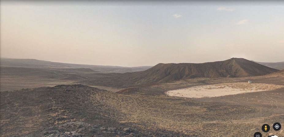
Harrat Al Shamah is the Saudi Arabian portion of a huge basaltic volcano field called Al Harrah that is located in the North-Western part of Saudi Arabia. It starts in Syria and extends through Jordan and onto Northern Saudi Arabia.
It is a landscape of rising and falling basalt lava fields, entirely made up of gravel plains and wadis (valleys) with scarce vegetation.
It runs for 210 km from the northwest to the southeast and is about 70 km wide traversing the banks of the Wadi (River Valley) Sirhan.
Harrat Al Shamah has:
- Huge Plain Expanses
- Basaltic Lava Flows
- Cinder Cones
- Tuff Rings
- Shield Volcanoes
- Areas for Nature Conservation
- Arabian Leopard Reserve
At its highest point, the field rises to 1,100 m at Jabal Amud (Pillar Mountain).
Harrat Al Shamah first took shape as a result of volcanic activity during the Oligocene (65-23 million years ago) and Quaternary (2.6 million ago) eras.
The first eruptions began at the southeastern part of the field in the Miocene period 1-14 million years ago. Further eruptions then occurred in the late Pleistocene era about 0.126-.012 million years ago.
During the periods between eruptions, sands blew onto the fields lava and today lava and sand are layered. Today, it is dormant, but eruptions also occurred a few hundred years ago and are likely to happen again.
Volcanic eruptions took place along long fissures. It also has grabens and fractures.
Since 1987, the Harrat Al Harrah has been designated as a Special Nature Reserve by the Saudi Wildlife Authority today known as the King Salman Nature Reserve.
This video (in Arabic) tells you where all the Wildlife Nature Reserves are in the Kingdom with maps to help you locate them.
Directions To Harrat Al Sharmah
Harrat Al Shamah lies 300 km north of the city of Tabuk or 200 km north of the Arar. If you are in the city of Amman in Jordan you can also travel overland to Al Shamah (300 km).
From Jordan: Drive south on Routes 40, 35 and 30 for 143 km until you reach the Saudi border. There you can take an eVisa and cross the border to arrive in the border town of Al Haditha. From Al Haditha, take route 65 and 85 passing Ithrah (50 km) and arriving at the town of Turaif a further 120 km. Between Ithra and Turaif there is a huge parking area next to the volcano field after 75 km. As you drive to Turaif, you can see Harrat Al Shamah volcano field on your right side, Enter the field at the car park entrance or anywhere along this route.
From Arar: Drive north out of the town of Arar on the King Fahd Road dual carriageway (Route 85). You will see the Arar Technical College on your right after 15 km. Drive for another 82 km, until you arrive at the village of Hazim Al Jalamid on your right. Veer left and continue on Route 85 until you reach the town of Turaif after another 164 km.
After leaving Turaif to continue for another 40 km on route 85 towards the town of Ithra and you will arrive at a big parking area to the entrance of the volcano field on your right. Find a convenient to enter and explore the volcano field on this route.
Useful Glossary and Definitions
| Term | Definition |
| Harrat | Arabic for a large area of rocky, stony terrain of volcano field |
| Basaltic VolcanoField | A large, individual area of volcanoes that contain landforms, lava fields, scoria cones, small shields volcanoes, maars, tuff cones, and tuff rings |
| Magma/Lava | Hot, molten rocks from or below the earth’s crust making explosive lava and solid (igneous) rock |
| Lava Field | Large, flat areas (100s km long) of lava flows of very fluid basalt (rock) through vents containing crystals, liquid, and bubbles and freezing to make solid volcanic glass |
| Scoria ConesCinder Cones | Common, small, oval-shaped volcanoes up to 300m high are found on basaltic fields made by blobs of solidified lava on single vents |
| Parasitic Cones | Cone-shaped volcanoes formed by eruptions on fractures on the flanks of the main but unstable volcanoes |
| Shield Volcano | Curved, wide, gently sloped, a shield-shaped volcano formed 100% by slow lava flows of highly fluid materials accumulating in broad layers of lava |
| Strato Volcano | Tall, (2500m) steep, cone-shaped volcano made of hard lava, tephra, and ash. Formed by highly viscous flows that cool and harden quickly |
| Monogenetic Volcano | A volcano that erupts only one time |
| Polygenetic Volcano | A volcano that erupts, repeatedly |
| Maar | A shallow volcanic crater with steep sides that is surrounded by tephra or wall of (solidified debris) deposits |
| Strombolian | A mild eruption shooting blazing hot cinders, rock fragments and lava bombs hundreds of meters high |
| Hawaiian | Gentle, slow, splattering, red hot eruption with creeping lava |
| Phreatic | An eruption caused by magma that instantly evaporates groundwater making an explosion of steam, water, ash, and volcanic bombs. |
| Phreatomatic | An eruption caused by magma that interacts with water making an explosion of steam, water, ash, and magmatic clasts (rocks). |
| Effusive | Gushing, bubbling |
| Tephra | Lumps of solid rock that form after an eruption from magma and ash etc. |
| Tuff | Igneous (solidified) tephra |
| Dome | Curved mounds produced from slow viscous lava flows occurring at plate boundaries near volcanoes and account for 6% of eruptions |
| Whaleback | Lava flows that form shield-like forms over long lava flow tubes kilometers long producing a series of open craters (skylights) |
| Comendite | Alkali igneous rock, light blue-grey rhyolite. |
| Fumarole | A hole or opening located near or in a volcano out which hot sulfurous gases emanate |
| Pyroclastic Flows | Fragments and lava flow of dangerous, fast, and very hot volcanic eruptions making escape very difficult. |
| Jabal | Arabic word of the mountain |
| Grabens | Slabs of the earth’s crust that sink into the earth causing parallel lined valleys. |
Useful Sources
- Volcano Discovery- Volcanoes of Saudi Arabia
- List of Volcanoes- Wikipedia
- Space Place NASA
- Volcano- Wikipedia
- Daily Express scientist discover strange gates